)
Services and transport
Servicing provision
01

Power Infrastructure and network
Power infrastructure and availability now determines where AI can be built. Power is the binding constraint.
The landholdings along Elizabeth Drive have exceptional existing access to the Transgrid and local electricity network including the following:
- 330 kV Transmission Line being Transgrid’s Line 39 connecting the Yass Regional supply to the Sydney West network. - Strategic access to the 330 kV line via Transgrid Pylon 508, close to Elizabeth Drive (and reducing cost to establish a grid tie in). - 33 kV distribution feeder running along Elizabeth Drive and under the 330 kV line, for initial staging or redundant A/B power supply.
The Power Infrastructure offers an exceptional Tier-ready site with scalable grid power already in existence offering deployment strategies not seen anywhere in Sydney.
The Power Infrastructure directly benefits uses that are permissible in the zone including: - Data Centres including Hyperscale Centres (50-150 MW + facilities), Edge Data Centres and Tier III/IV Modular Centres - Battery Energy Storage Systems (BESS) - Hydrogen Production Facility (Electrolysis Based) - Advanced Manufacturing/Clean Tech - Aerospace and Drone Operations Hub - High Performance Computing / AI Training Hub - Multi-tenant Technology Park / Campus - Research Facilities. Many recent SSD applications in Western Sydney are now spending billions of dollars on access to power, and power is the binding constraint for all future AI. A look at the $1.3 billion 190MW Microsoft Data Centre under construction at Kemps Creek is shown below:
The Power Infrastructure directly benefits uses that are permissible in the zone including: - Data Centres including Hyperscale Centres (50-150 MW + facilities), Edge Data Centres and Tier III/IV Modular Centres - Battery Energy Storage Systems (BESS) - Hydrogen Production Facility (Electrolysis Based) - Advanced Manufacturing/Clean Tech - Aerospace and Drone Operations Hub - High Performance Computing / AI Training Hub - Multi-tenant Technology Park / Campus - Research Facilities. Many recent SSD applications in Western Sydney are now spending billions of dollars on access to power, and power is the binding constraint for all future AI. A look at the $1.3 billion 190MW Microsoft Data Centre under construction at Kemps Creek is shown below:

This unique co-location of power infrastructure is a decisive advantage for these landholdings.
The lands along the Elizabeth Drive frontage are therefore in a superior position compared to most landholdings in the Aerotropolis or Sydney Basin — ensuring scalability, resilience, and speed to market for global hyperscale operators.
This is illustrated in the diagram below, that shows the only interconnection of the 330kV (blue) and 33kV (red) lines in this area.


Fibre Infrastructure and Connectivity
Unlike any other area in the Aerotropolis, the landholdings along Elizabeth Drive offer Multiple Fibre Network Infrastructure providing a rich fibre presence from:
- Transgrid Lumea & Data Centre Interconnect - Operates an extensive, independent 'Fibre in the Sky' network, engineered with fibre optics encased within multiple layers of aluminium and steel, suspended 30 to 65 metres above ground (called the OPGW network). This robust design offers genuine network diversity from terrestrial fibres and has proven resilient, maintaining reliable operation during extreme weather events like fires and floods. Its so good, it is used by Western Sydney Airport for its Digital Control Tower which access the CDC Data Centre / Digitised Aerodrome Service in Eastern Creek.
Data Centre Interconnect connects many data centres across eastern Australia.
Lumea's Data Centre Interconnect services powered by Lumea Wavelength/Spectrum as part of this system deliver secure, efficient, point-to-point reliable connectivity with scalable bandwidths, facilitating seamless data transfer between many data centres across Australia (such as Next DC, Leading Edge and Equinex).
- AARNet – Australia’s Academic and Research Network. Access to the AARNet allows access to research networks and government facilities offering low-latency, high-capacity connectivity designed to meet the specialised needs of the research and education sector. AARNet is rarely found adjacent to Transgrid Lumea and Data Centre Interconnect. It is used by universities, research institutes, hospitals and other government agencies (including Defence industries).
- Telstra Fibre - Provides national enterprise fibre with dark and lit services available, ensuring robust and reliable connectivity options.
- Optus Fibre - Offers metro commercial fibre, delivering high-performance, low-latency connections suitable for various applications.
The frontage along Elizabeth Drive is provided with this quadruple fibre connectivity making this a rare and strategically valuable carrier aggregation point not seen in many areas anywhere in Australia.
It provides carrier diversity and suitability for carrier-neutral data centres and other multi-tenant environments for other high-technology uses.
Few sites and areas offer four commercial grade fibre routes. Coupled with other aspects of the landholdings such as the Power Infrastructure, Recycled Water and 24m high permissible/building heights, this area is a rare, high-performing, future proof and ESG aligned site.


Data Centre Interconnect is being utilised by Western Sydney Airport and by Digital Aerodrome Service/CDC Data Centres via Transgrid’s Line 39. Western Sydney Airport will operate their Digital Air Traffic Control Tower via the same Data Centre Interconnect line. The photo below shows the two Digital Air Traffic Control Towers located on either side of Transgrid's Line 39.


Town Water and water supplies
Sydney Water has identified the lands on the western boundary of the airport to be provided with drinking water services in 2026-28, which is the earliest of all precincts within the Aerotropolis.
Refer to the Sydney Water Growth Servicing Plan 2025-2030 for more details.
Sydney Water also completed the construction of a new water main along Adams Road in 2023. This main will supply water to the Airport. This water supply will also be one of the first water mains for any employment lands within the Aerotropolis.
The photo above shows the 750mm (internal diameter – 1000mm external diameter) water main construction along Elizabeth Drive at Adams Road, on the western boundary of the airport (June 2022).
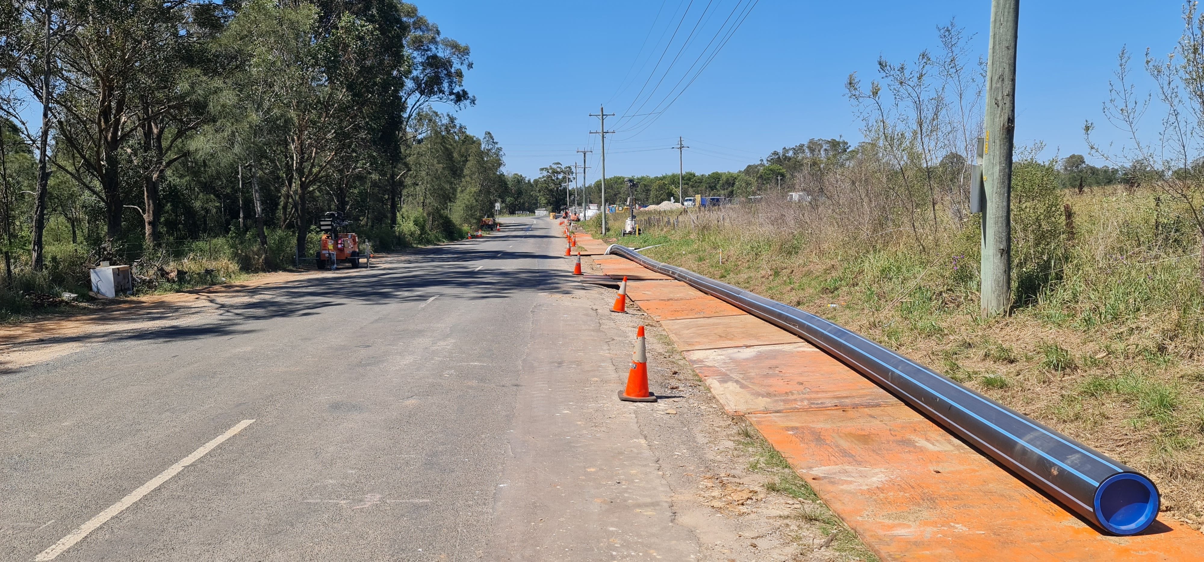
Photo below shows new 355mm water main being installed by Sydney Water along Adams Road from the Elizabeth Drive main (February 2023). Hydrants along Adams Road and Anton Road are now installed.
The water main along the remainder of Elizabeth Drive will be constructed in 2026.

sewer and recycled water
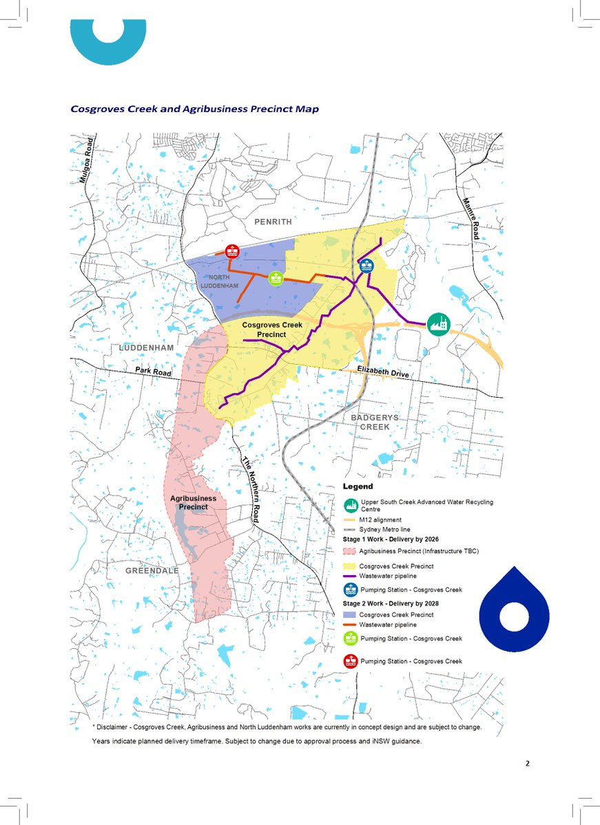
Sydney Water has identified lands on the western boundary of the airport to be provided with wastewater/sewer services by 2026. The Upper South Creek Networks Program has identified the Cosgrove Creek Precinct (where the landholdings are located) as being Stage 1 to be delivered by 2026 (as shown in diagram above).
The landholdings on the western edge of the airport will therefore be serviced with sewer first, as they are located within the Cosgrove Creek Precinct similar to the Northern Gateway. Other lands within the Agribusiness Precinct don’t drain to this catchment (they are in the Nepean River Catchment) and will require extensive pumping stations and infrastructure to pump their sewer into the South Creek Catchment lines when they are built and operational.
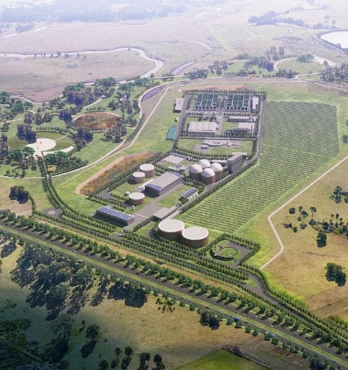
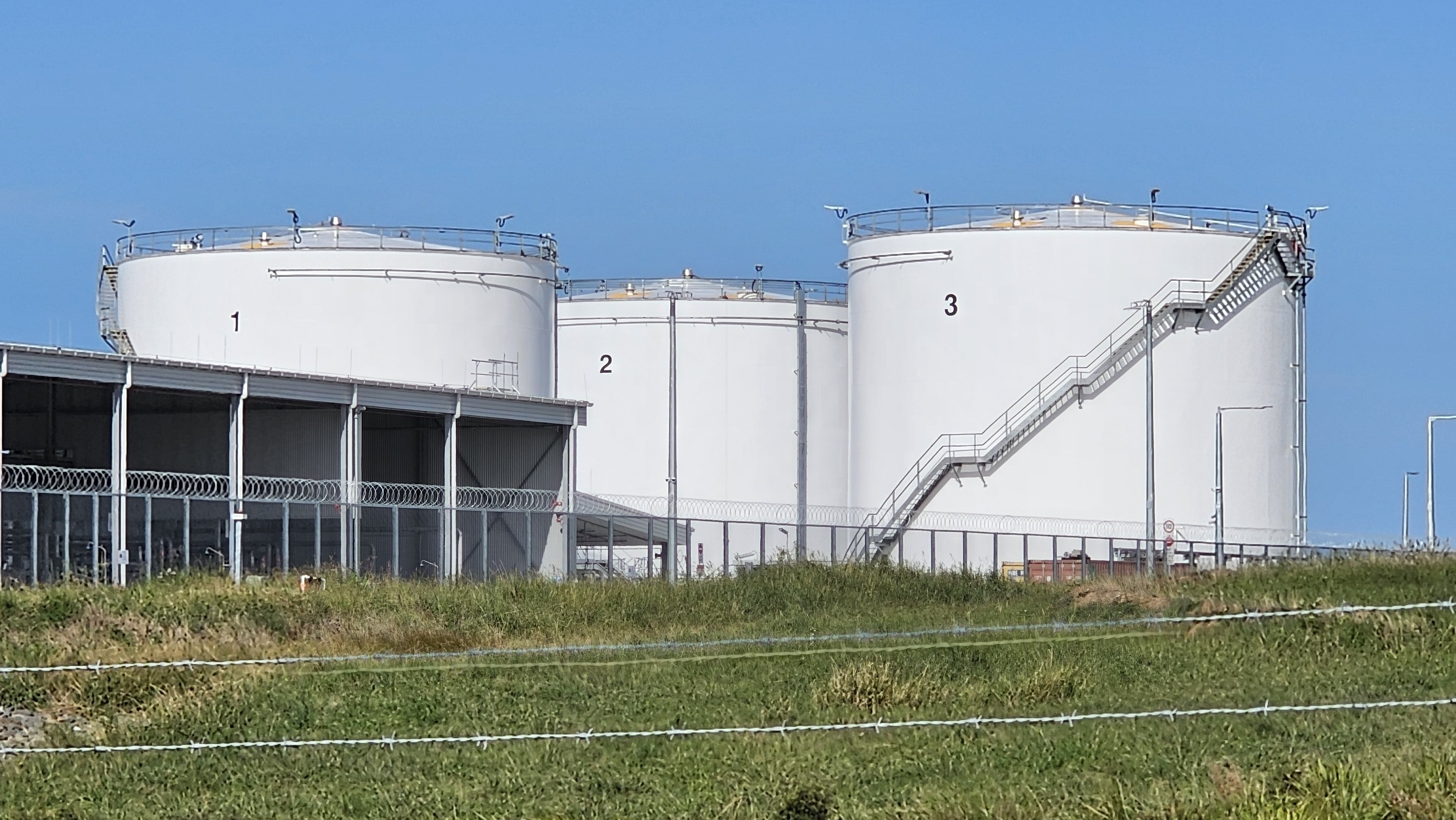
Recycled wastewater is also being provided to these lands, and a recycled water supply line (purple line) will also be available for use by industry. This line is being built along Elizabeth Drive from the new Upper South Creek Advanced Water Recycling Centre which has started construction and is located along Clifton Avenue in Kemps Creek (for completion by 2025).
The diagram above shows the location of the site in relation to this project while the photo below shows the proposed centre. Works were completed on this line along Elizabeth Drive in 2024, with these construction works being undertaken by John Holland.
Recycled water is essential for meeting sustainability targets. For example, recycled water allows for ESG aligned development (Environmental, Social and Governance). It can be used for cooling systems in industry such as for data centres. The landholdings along Elizabeth Drive will therefore be provided with early access to the reticulated recycled water system to facilitate all forms of industrial development.
Refer to the Sydney Water Growth Servicing Plan 2025-2030 and the Sydney Water homepage for more details.
The latest diagram from the Upper South Creek Networks Program and the site location (yellow arrow) is shown below.


The pumping station for the Cosgrove Creek Precinct wastewater system is seen above starting construction next to the Metro line near Luddenham Metro station (November 2025).
The Upper South Creek Advanced Water Recycling Centre at Kemps Creek is shown below, next to the M12 Motorway (October and November 2025).


the Transport network
02

Elizabeth Drive and the northern road
The Northern Road dual carriageway upgrade has been completed at a cost of $1.6 billion and serves the landholdings on the western edge of the airport.
Elizabeth Drive is the other main road that forms the northern boundary of the lands and is being upgraded to a new dual carriageway roadway. The upgrade of Elizabeth Drive is now in progress with investigation works progressing on the project since 2022.
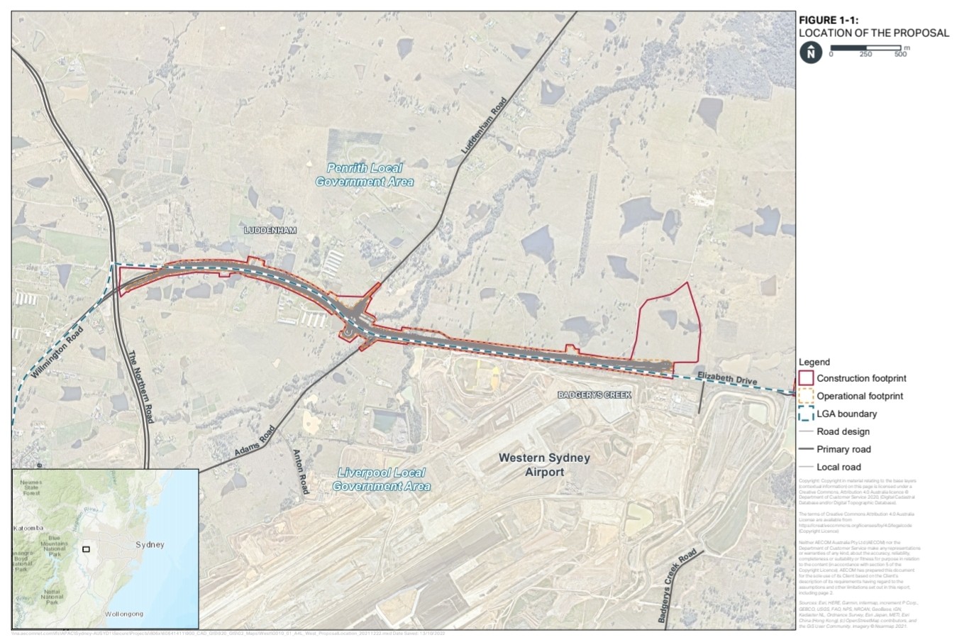
Transport for NSW in late September 2023 released the Review of Environmental Factors for Elizabeth Drive details of the upgrade provided in two parts, with the Elizabeth Drive West Upgrade section to be completed separtely from the remainder of Elizabeth Drive (proposal shown below).
The NSW State Government also announced further funding for the construction for Elizabeth Drive in the 2024-25 NSW Budget, with $800 million being allocated for Elizabeth Drive as a four lane road between The Northern Road and Mamre Road.
Both these roadways are classified main roads, with no load limit or height limit restrictions and comply with NSW HML and RAV limited roadways for large vehicles (unlike other roads for other precincts, such as the current 5 tonne limit on Luddenham Road).
Elizabeth Drive will also be provided with a Rapid Bus Network to Liverpool and connect the lands on the western side of the airport to the M12 and the rest of Sydney, better than any other Aerotropolis locality.
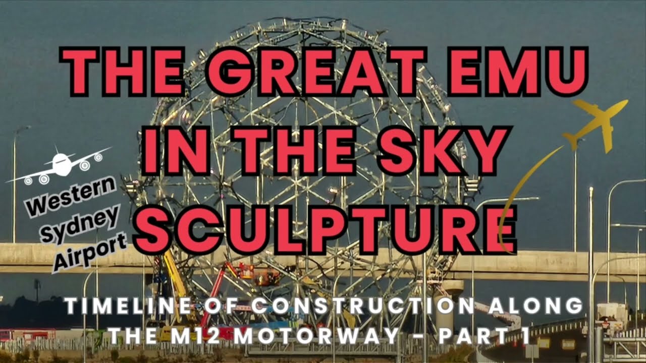
The connection of Elizabeth Drive to the M12 Motorway via Warami Drive is shown in the photo below (The Great Emu in the Sky sculpture in background) along with design proposal for its future upgrade.


M12 Motorway, the Future M9 Outer Sydney Orbital & western sydney Freight line

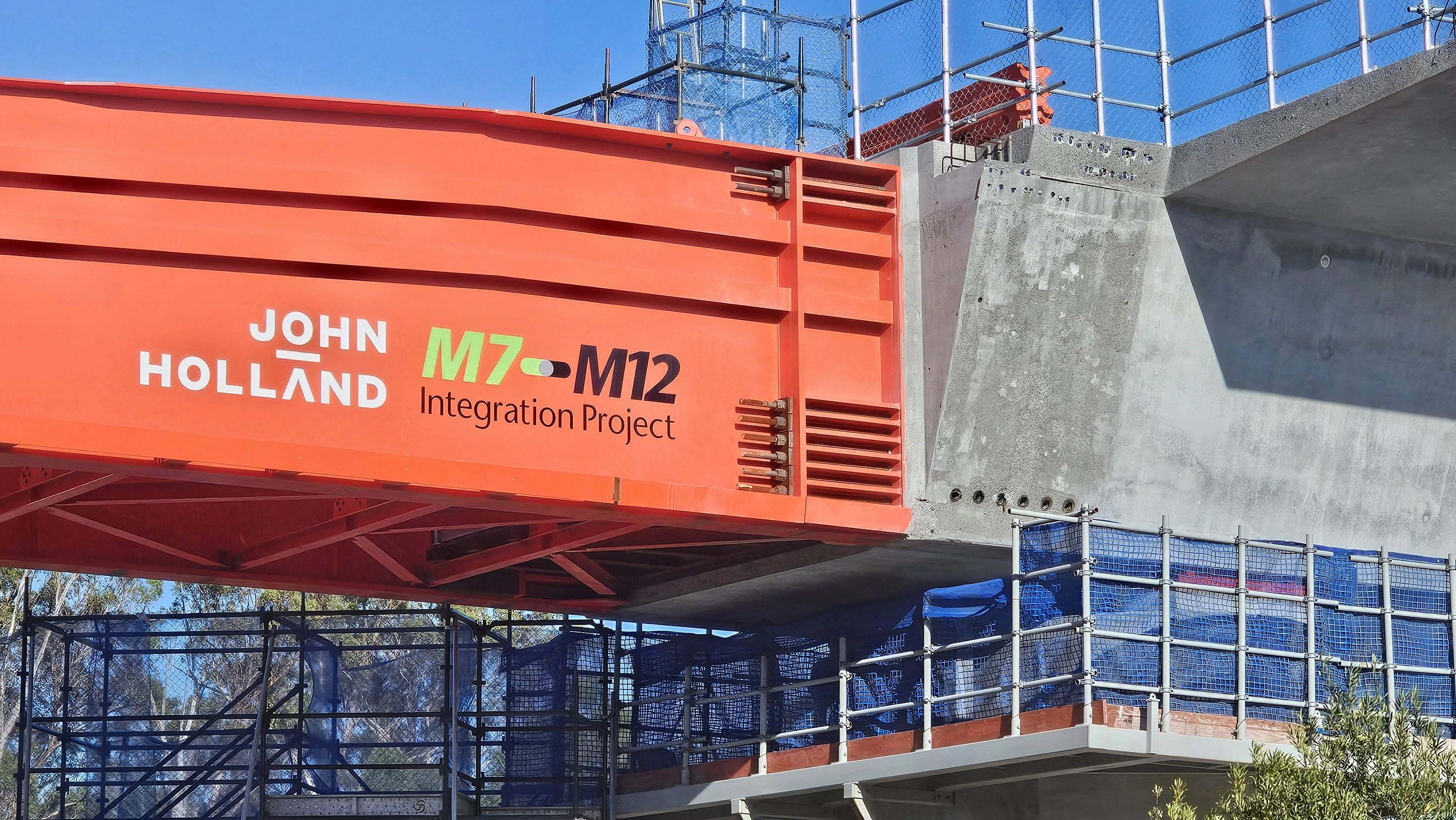
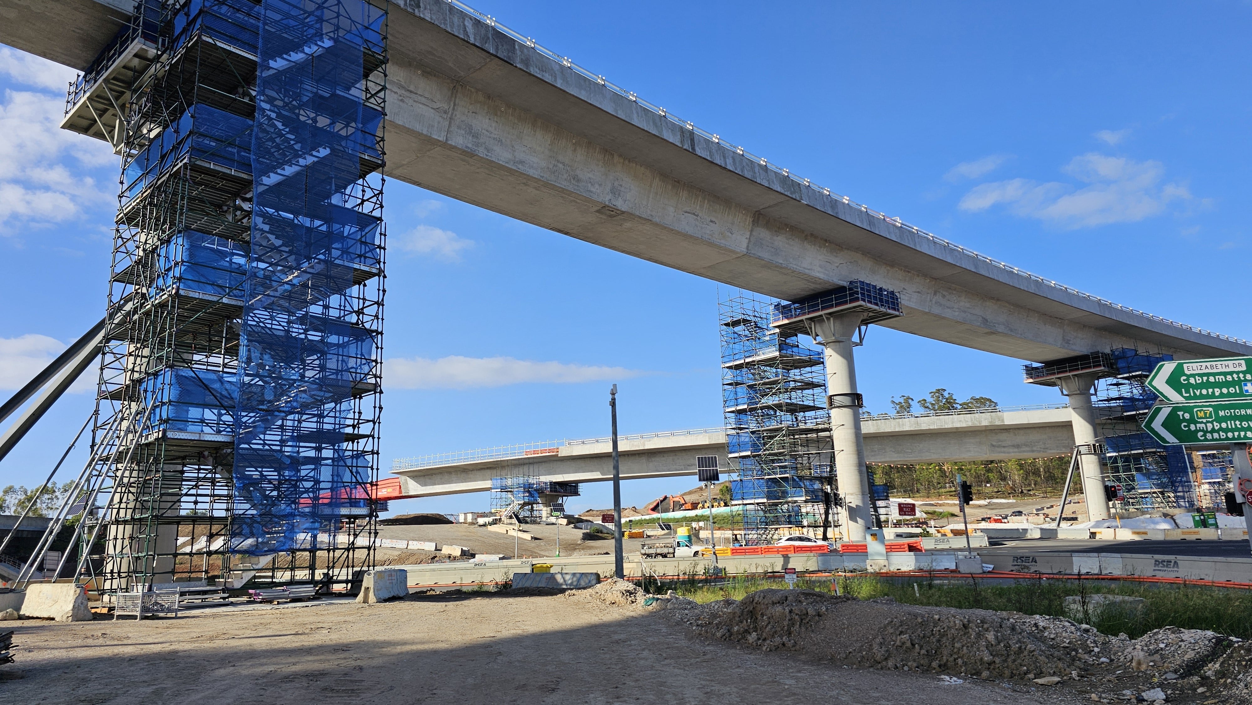
Construction work has begun on the M12 Motorway located within 1km of the subject landholdings on the western boundary of the Airport. The location of the site in relation to the approved M12 Motorway design is shown above.
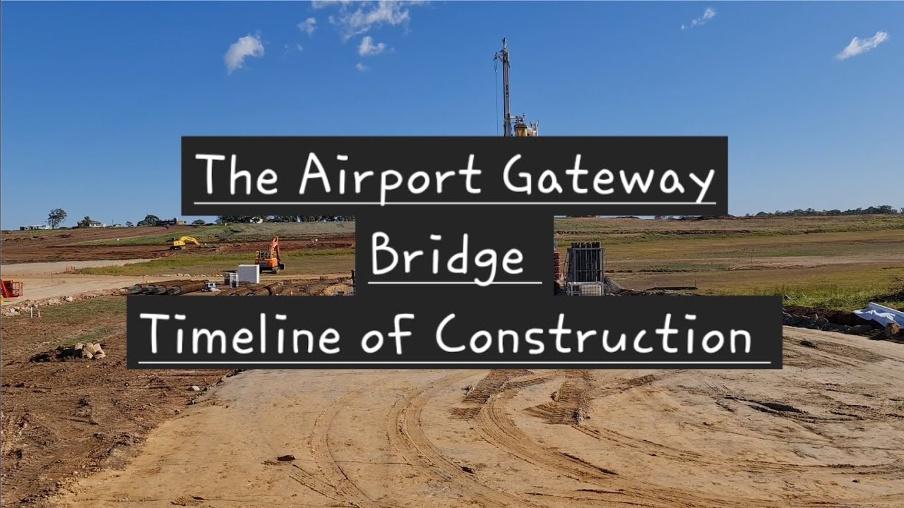
The M12 Motorway connectivity will link the area to the remainder of Sydney and is to be completed for the airport completion in 2026. The landholdings on the western edge of the airport will benefit from two toll-free M12 connections at Elizabeth Drive and The Northern Road, for the best road transport connections of any lands within the Aerotropolis. Works on the M12 Motorway has been progressing at a fast rate, with many of the bridge structures such as the Airport Gateway Bridge and Luddenham Road bridge (Bridge BR01, as shown below) nearing completion. The Airport Gateway Bridge was opened to Elizabeth Drive traffic on the 11 March 2024 and a timeline of its construction is shown on our YouTube channel.
The future M9 Outer Sydney Orbital is also proposed to connect to the M12 at The Northern Road when built in the future (and this transport corridor preservation is now occuring). Transport for NSW has also indentified this Outer Sydney Orbital area for future freight rail line connecting to the proposed Western Sydney Freight Line.
The Western Sydney Freight Line (Stage 1) is a dedicated freight line between Horsley Park and Luddenham and the Western Parkland City. A future Stage 2 allows for the connection to the Southern Sydney Freight Line at Leightonfield, linking to Port Botany via the Metropolitan Freight Network.
Refer to the Transport for NSW homepage for more details on all of these projects.

.jpg)


Anton Road North - a new airport entry
Anton Road North will be the main services entry point into the western boundary of the airport (including the fuel supply). This roadway will be a sub-arterial road that will connect to a new signalised intersection at Elizabeth Drive. Anton Road North will then extend through Elizabeth Drive to lands in the Northern Gateway Precinct.
Refer to the Transport Network under the Aerotropolis Precinct Plan for details.
The photos above and below show the new intersection at Adams Road and Anton Road under construction and its completion for improved airport access to The Northern Road.
The photo above shows the direction of the future Anton Road North along landholdings on the western side of Adams Road. The photo below shows the new roundabout construction and new services entry road along Anton Road to Western Sydney Airport (July 2022).


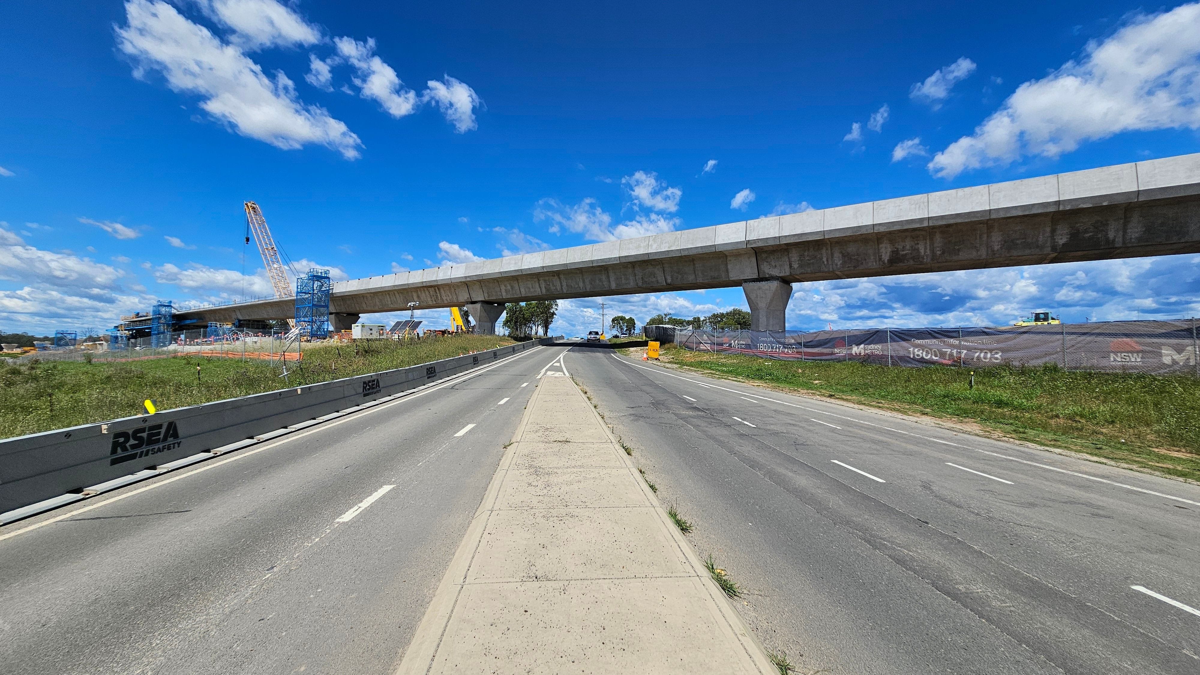
Sydney metro - western sydney airport
Construction work is well underway on the Sydney Metro – Western Sydney Airport Metro rail line which will connect the area to Sydney’s rail transport network.
The new Metro line will connect the western Agribusiness lands to the rest of Sydney with reliable public transport including interconnecting bus services to all Metro Stations and nearby stations at the airport (two stations) and another at Luddenham.
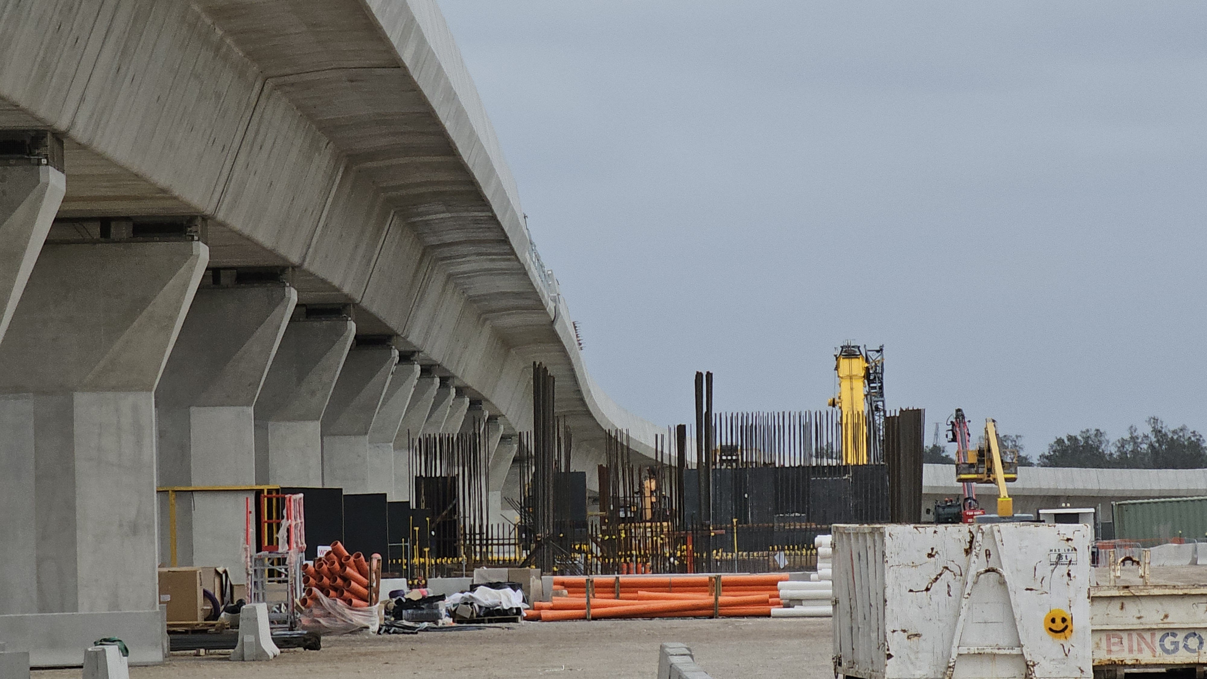
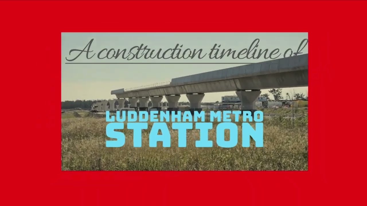
Works along Luddenham Road and at the Luddenham Metro Station have also been progressing quickly as shown in the photos below.
Refer to the Sydney Metro - Western Sydney Airport Metro homepage for more details.

.jpg)
.jpeg)
.jpeg)
.jpeg)
.jpeg)
.jpeg)
.jpeg)
.jpeg)
.jpeg)
.jpeg)
)
Do you need more information on servicing and transport in this area?
Contact us through the email below for further details.